
The information on this page comes exclusively from the official records of FEMECV (the Valencian Community Hiking Federation) and Onda Town Council, and is provided for general information purposes only, with no commercial intent. GuiaOnda has not walked this route and does not verify the current condition of waymarking, the trail alignment, or the terrain, and assumes no responsibility for the accuracy or currency of this information.
According to FEMECV's own records, this route has not undergone a recent quality inspection, so waymarking may be incomplete or absent in some sections. Hiking carries inherent risks that each person must assess and accept individually. Before you set out: download the GPX track to a dedicated device (not just your phone), check the weather forecast, carry appropriate mountain equipment, and let someone know your planned itinerary. GuiaOnda accepts no liability for injury, accidents, getting lost, or any other loss that may result from using this information.
The SL-CV 107 is the most accessible and varied of Onda's certified hiking routes. In just over two hours the trail moves through several distinct worlds: the historic urban setting of the Molí de la Reixa, the dry bed of the Riu de Betxí, the cork oak forest of the Sierra de Espadán, and the Santa Bárbara chapel from which you can see the castle, the Plana plain and, on clear days, the Mediterranean. The return descent, along a narrow path through aromatic scrub, is one of the most pleasant sections of the trail.
The starting point at the Molí de la Reixa: an 18th-century flour mill that now houses the municipal tourism office: gives historical context before you even set foot on the mountain. A short distance away, the enclosure of the Torrelló, a medieval watchtower, is a reminder that this path served for centuries as a communication route between the town and the mountain farmland.
Route and waypoints
- 1Molí de la Reixa: Starting point. Municipal tourism office. Parking available.
- 2Riu Sec de Betxí: The trail follows the dry riverbed. Sandstone terrain with dry riverbank vegetation.
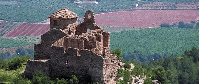
- 3Santa Bárbara Chapel: Highest point of the route. Views of Onda castle, the Plana Baixa and the Mediterranean.
- 4Saddle: Junction with other sierra paths. Start of descent along a narrow trail through cork oaks and aromatic scrub.
- 5L'Horta d'Artesa: Area of traditional mountain vegetable plots. The landscape changes to cultivated terraces and farmhouses.
- 6El Carme: Peripheral neighbourhood of Onda. The trail returns to the urban setting to close the loop back to the Molí.
What to see along the way
The Santa Bárbara chapel is the visual highlight of the route. The small chapel, simply built, occupies a privileged position overlooking the entire Plana Baixa. Onda castle, with its medieval towers, frames perfectly from here: it is one of the finest vantage points over the whole complex.
The stretch through the cork oak forest is especially striking in spring, when the ground is carpeted with flowering cistus and rosemary. The cork oak woodland of the Sierra de Espadán is one of the most extensive in the western Mediterranean, and the trail skirts it through several sections. Look out also for cork oaks whose bark has been stripped: the harvesting of cork remains a traditional activity in the sierra.
Practical tips
The trail is suitable for walkers with basic experience. The 255 m of elevation gain is moderate and concentrated in one main uphill section. Bring enough water: there are no accessible water sources on the route. The best seasons are autumn and spring; in summer the heat can be intense from midday onwards. The official GPX track is available on the FEMECV register.