
A sandstone wall facing the coastal plain
As you near the cliff wall from Onda, crossing through orange groves and pine forests, you understand why this sierra marks the frontier between the mountains and the plain. The Aragonese Peaks (Peñas Aragonesas) are a face of red sandstone cliffs rising between the municipalities of Onda, Artana and Tales, on the foothills of the Sierra de Espadán.

The red sandstone (known locally as rodeno) forms vertical walls and isolated boulders that erode into very distinctive shapes.
The trail: a half-day circular route
Around 10-12 km of circular trail with 400 m of positive elevation gain: approach tracks through citrus groves, pine forest and cork oak woodland, plus rocky trail sections along the base of the cliff wall.
This is not a gentle stroll. It is designed for people comfortable walking in mountain terrain. The more technical sections follow the base of the rock face, where the ground is uneven. The route shares part of its alignment with PR-CV paths (Tales-Peñas Aragonesas-Artana).
Views and landscape
In the lower section the path crosses the citrus orchards: wide tracks, rows of trees and flat terrain. As height is gained, pine woods and cork oak patches appear, with Mediterranean scrub of rosemary, heather and cistus. In the upper section, close to the peaks, the sandstone forms vertical drops, isolated boulders and small ledges that serve as continuous viewpoints over the Plana.
From the high points you can clearly make out Onda, the grid of orange plantations, and on clear days the Mediterranean shoreline and peaks such as Penyagolosa. Along the ridges it is common to see raptors gliding, mainly kestrels and common buzzards, exploiting the thermals rising off the rock faces.
The route from Onda
The usual starting point is the Onda Country Club or the car park next to the municipal cemetery, both south of the town centre. From there, agricultural tracks run through the orchards: roughly 3-4 km of almost flat terrain with the peaks visible ahead as a natural landmark.
Crossing the Rambla de Artana marks a change of terrain: pine forest and cork oak paths replace the tracks and the route gains height steadily. Along this section, waymarking for the PR-CV 139 trail (Tales-Peñas Aragonesas-Artana) appears intermittently. The final ascent to the viewpoint covers roughly 200 m of elevation in just over a kilometre, over rocky ground.
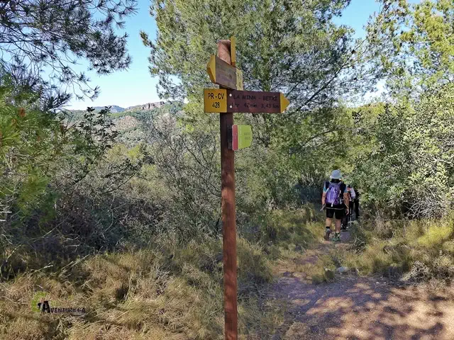
The full circular is around 10-12 km and 3-4 hours at a relaxed pace with stops. There are no reliable water sources on the route: bring enough from the start. Track junctions in the lower section can be confusing; a downloaded GPS track (Wikiloc has several user tracks) helps stay on course. Mountain footwear, sun protection and, in summer, an early start.
More about this trail
Trail photos, video and downloadable GPS track