The information on this page comes exclusively from the official records of FEMECV (the Valencian Community Hiking Federation) and Onda Town Council, and is provided for general information purposes only, with no commercial intent. GuiaOnda has not walked this route and does not verify the current condition of waymarking, the trail alignment, or the terrain, and assumes no responsibility for the accuracy or currency of this information.
According to FEMECV's own records, this route has not undergone a recent quality inspection, so waymarking may be incomplete or absent in some sections. Hiking carries inherent risks that each person must assess and accept individually. Before you set out: download the GPX track to a dedicated device (not just your phone), check the weather forecast, carry appropriate mountain equipment, and let someone know your planned itinerary. GuiaOnda accepts no liability for injury, accidents, getting lost, or any other loss that may result from using this information.
The PR-CV 360.1 is the longest and most strenuous of Onda's certified routes. Its 15.3 km and nearly 600 metres of cumulative elevation gain make it a full day on the mountain, intended for experienced hikers. What sets it apart from the rest is its destination: the sandstone formations known as The Pyramids, a cluster of red sandstone needles and columns that evoke landscapes of the Iberian interior, unusual in the Mediterranean context of this sierra.
The starting point is the Molí de la Reixa, on the edge of Onda's historic centre. The route leaves the urban environment quickly, following the Riu de Betxí before climbing via rural tracks and forest paths to the upper sierra. The Pyramids section, at the heart of the route, breaks with the cork oak scenery and opens up a space of dramatic visible geology that fully justifies the effort of reaching it.
Route and waypoints
- 1Molí de la Reixa: Starting point. Municipal tourism office. Parking available.
- 2Riu Sec de Betxí: The trail follows the dry riverbed across sandstone terrain with dry riverbank vegetation.
- 3Camí dels Masos: Section along rural tracks between dryland fields and old farmhouses. The landscape alternates abandoned cultivation and low pine forest.
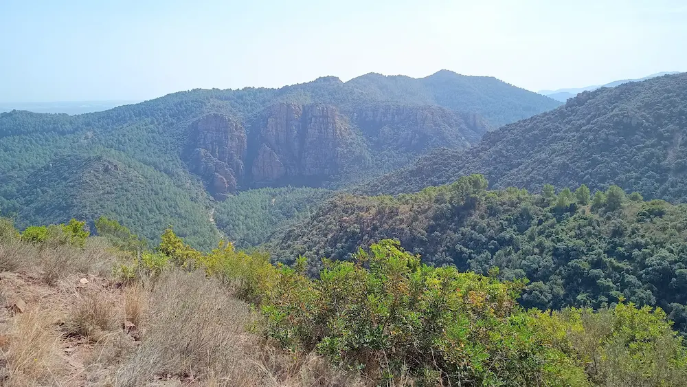
- 4The Pyramids: The most singular point of the route: red sandstone columns and needles. Maximum geological and scenic interest.
- 5Upper saddle: Broad view over The Pyramids and the sierra valleys. Rest area before the descent.
- 6Font de la Serra: Spring on the descent. Shaded area among cork oaks. Water may not be available in summer.
- 7El Carme: Peripheral neighbourhood of Onda. The trail closes the loop back to the Molí de la Reixa via a short paved stretch.
What to see along the way
The Pyramids are the centrepiece of this route. The red sandstone (Triassic age) formations in this sector of the sierra have been eroded by water and wind into columnar shapes that, seen from certain angles, recall the hoodoo formations or badlands of the Iberian interior. It is a landscape rarely seen in the Valencian Community and one of the most striking geological interest points near Onda.
The cork oak forest of the Sierra de Espadán accompanies much of the route. The variety in cork oak size, from saplings to centuries-old trees with stripped trunks, lets you observe the different phases of cork harvesting that continues as a traditional activity in the sierra.
The length of the route allows you to witness the changing landscape across the day: the urban and historical atmosphere at the start, the dry riverbed and red rock of the Betxí, the density of the upland cork oak forest, and the sudden opening of The Pyramids. Few routes of this distance concentrate such variety of setting.